Country maps / route maps / maps - where is it going?!
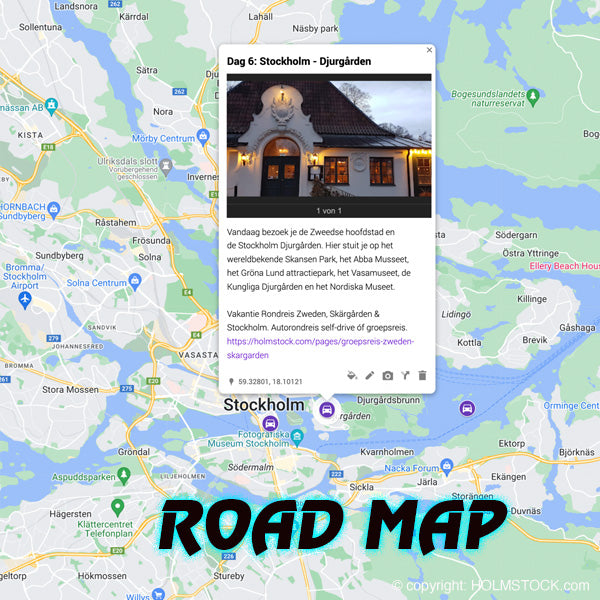
Route maps for our travels. We have thought for a long time about how we are going to approach this. You will see a different solution online at the various travel providers on each site. They are often cards that appear as a photo next to the itinerary, sometimes small, sometimes larger. We wanted to do this differently and more efficiently.
We have chosen to create maps in Google Maps. We can place the dot of that day's destination on the maps each day. The dots are not connected by a line, but if you follow the order you will understand which route will be involved in broad terms.
The link to the maps will always be at the bottom of the page, directly below the daily program. 
Interactive maps of the trips:
If you click on the dots, a small window will open with a short text and a photo. This solution offers you much more information and because it is based on Google Maps you can zoom in and out as you normally would. The link always goes to the relevant trip. We were able to successfully test this link on the desktop. It doesn't seem to work (yet) on a mobile phone. Hopefully that will also work out soon :)
CLICK HERE and see an example. Our trip to Malmö - Gränna - Stockholm
We hope you enjoy it and find the information you are looking for. Your feedback is of course always very welcome!

